Advertisement

hydraulic erosion on terrain height map

Started by September 24, 2021 07:42 PM
2 comments, last by JoeJ 3Β years ago

Hi guys,

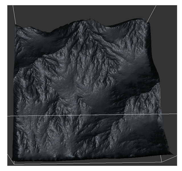
I need a bit of starting point for the hydraulic erosion on terrain height maps. I want to convert any random generated cloud noise map as a height map and want to erode it so that it looks natural like real world mountain ranges.

what should be a good starting point as I am currently unaware of such hydraulic erosion method. How people do it to generate really convincing looking terrain height maps.

little bit I know about this is that it involves fluid flow, sedimentation and deposition. How to actually perform this algorithm. Kindly direct me to a good c++ paper or resource.

your ideas are most welcome.

thanks!

There is a github repo in the info of this video. Sub to the channel.

ED: sorry, I think it's done in Unity. Still might be useful, even the c# code.

Coding Adventure: Hydraulic Erosion

https://www.youtube.com/watch?v=eaXk97ujbPQ

πŸ™‚πŸ™‚πŸ™‚πŸ™‚πŸ™‚<←The tone posse, ready for action.

Advertisement

This is also very nice, was the starting point for me: https://github.com/LanLou123/Webgl-Erosion​

I improved it with considering all 8 neighbouring cells to calculate gradients, simulation at multiple frequencies, some other things. Results look like this:
​

EDIT: In case you don't know, there are very good tools around. Sometimes free to use for small sizes.
https://quadspinner.com/​
https://www.world-creator.com/​
https://www.world-machine.com/

This topic is closed to new replies.

Advertisement