I think I am gonna use the latitude and longitude. Though what I am doing is making it so that the world map would be comprised of units put toget so it looks like this flat
---/\----/\----/\
--/--\--/--\--/--\
-/----\/----\/----\
-\----/\----/\----/
--\--/--\--/--\--/
---\/----\/----\/
etc etc. Until it is long enough
The diamonds themselves would be comprised of trapezoids to prevent any area from becoming to large to manage
Then with the class I will using latitude and longitude for the coordinate system, with the move system based on north south east and west, not up down left and right.

22 users logged in
Proud partner of GDC 2025

Before posting, review our community guidelines.
Support GameDev.net with a monthly GDNet+ subscription!
Spherical Map design

256
July 19, 2004 01:41 PM
how about abandoning tiles alltogether?
make sphere and use vectors and translate the spherical movement... a global civilization?
make sphere and use vectors and translate the spherical movement... a global civilization?
-----------------www.stevemata.com
1,845
July 21, 2004 11:06 AM
Aren't trapezoids just three triangles stuck together? Go with the icosahedron, and load five or so triangles per "area".
Could you explain a little more accurately what you're going for here? Do you want your characters to be able to get in an airplane and fly around the world, or orbit in a shuttle, or climb a mountain and look over the landscape until the planet's curve obscures their vision?
If you're just going from place to place on the surface, you can use "warp points" to transition from one 2D map to the next and just work out the warps to give the proper spherical feel. If you're going to have orbital versus ground work, then a big procedurally textured sphere could be used for "space view" and then the aforementioned 2D system could be used when you land. The only time you'll need a really sophisticatedsystem would be if you were flying around the world in a hot air balloon or something, and needed the poles, etc. to be in the right places.
In that case, you could have a 3D object for the globe, and have each significant area represented by a miniature of itself on that globe. But when you land/get close to the ground/send a probe/whatever, it'll transition to the 2D form.
So you've got three manifestations of your world: There's the big sphere as seen from space, the complex topographic model seen from the air, and the series of interconnected 2D maps used when you're on a motorcycle or just hoofing it. If you do this, I don't doubt that Wavinator has done mountains of research on effective implementations.
3,454
July 22, 2004 01:06 AM
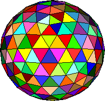
Geosphere:
Although it can't be mapped onto a rectangular 2D surface, it can still be done programatically.
Although it can't be mapped onto a rectangular 2D surface, it can still be done programatically.
136
July 24, 2004 10:56 AM
A Geosphere is just an Icosahedron on a higher Level of Detail. If you want an accurate spherical map, you only have two basic choices: Spherical Coordinates (Longitude and Latitude) or Tesselated Triangles (Octahedron, Icosahedron, Geosphere).
I am the master of ideas.....If only I could write them down...
280
July 24, 2004 01:37 PM
I'd just like to point out that this has been done, AND using a rectangular tile map, in the game Populous by Bullfrog. Have a look at any screenshot of the game and you'll see. Maybe it's worth your time doing a search to see if you find an article on how they did it ;)
122
August 17, 2004 04:13 PM
I'm thinking the actual map like you say is rectangular/square, and just wrapped, then you just "fudge" (i.e. use clever techniques whatever... :-p) your rendering to "look" as if the screen is curving around.
If anybody has ever played the Sonic 3 game on the genesis/mega drive, Sonic appears to be running around a globe in the special stages. The actual map data for those globes is just a square (you'll know if you've ever played around with the level editors for those things) and thus you'r tricked into thinking its all physically accurate.
There's always an easy option thats good enough for games :-p
Most players probably dont even notice that its not physically true anyways...
Regards,
Chris
This topic is closed to new replies.
Advertisement
Popular Topics

Advertisement
Recommended Tutorials
Advertisement